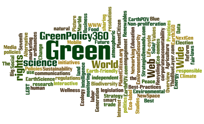
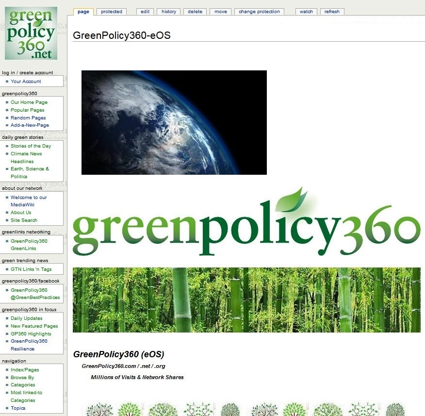
Your MediaWiki eco operating system
Global green best practices
Tens of millions of visitors, views & shares in our connected 360 world
#PlanetCitizens making a positive difference in today’s world — and in our children’s future


Tens of millions of visitors, views & shares in our connected 360 world
#PlanetCitizens making a positive difference in today’s world — and in our children’s future
As a pioneer in the data marketing/media/mobile industry, M Channel brings our partners a legacy of forward-thinking innovation. Over the years, we have developed, launched and managed multiple award-winning programs. Our digital connectivity and networking deliver your message with personalized, precise marketing.
We share your vision with your target audience as we reach, engage, motivate and convert with calls to action.
Our data marketing and digital new media intersect politics and education, business and public interest work.

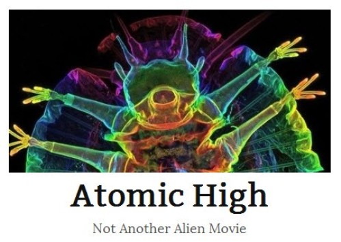
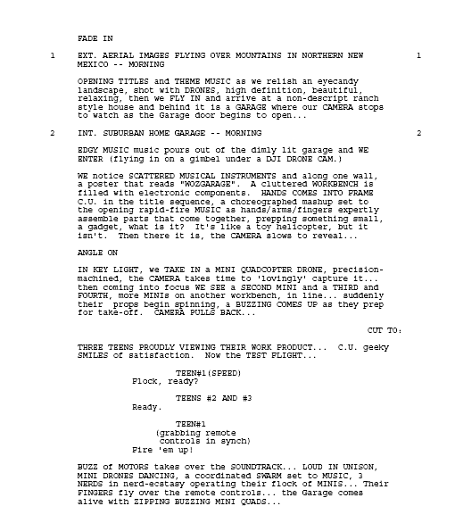
The gang of kids at a school nicknamed “Atomic High”, in a secretive high mesa town of the U.S. National Lab that built the first nuclear weapon, heard the late-night Pueblo drums along the Rio Grande. A local Indian, a salvage business buyer-and-seller of thrown away lab equipment, warns the kids of ‘a visitor’. The kids shrug off their Indian friend. What’s more important is the local fast food drive-in — that and their garage-born, cutting-edge Mini-Quad copters. The Quads are drones and the kids are called geniuses as are their parents who are real-world geniuses with Ph.Ds and a gazillion accolades. Genius is everywhere in the smartest town in America. But what’s just arrived on the mountain above Los Alamos brings a surprise — and the Atomic High gang is about to find out there’s genius and then there’s beyond genius…

Aspen Marketing Services, a story of the roots of M Channel & the interconnectedness of an Aspen community
The Aspen community, one of nature’s thriving successes, became a vision…
Our multi-division company, with interactive/direct/event/promotion and many front-of-market services, actively grew with connectivity of an Aspen network…

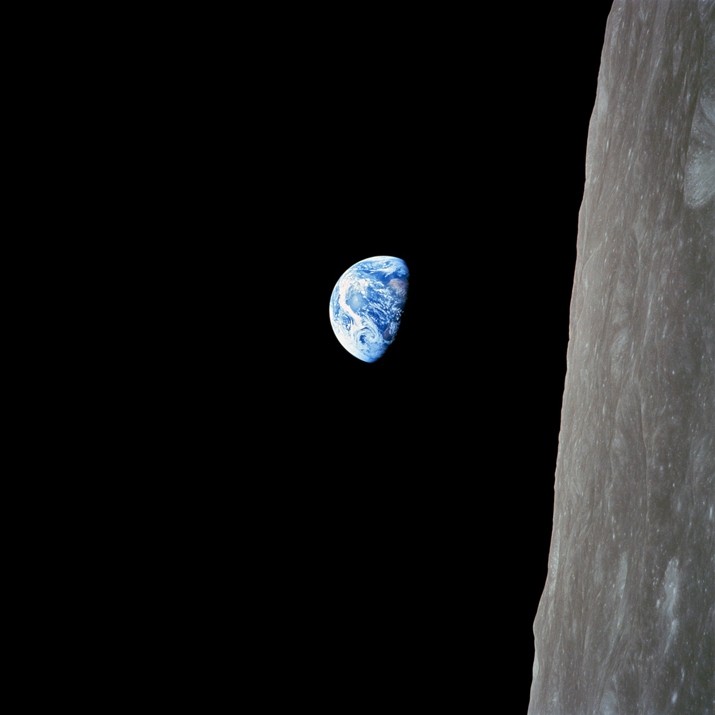
• https://www.greenpolicy360.net/w/File:Apollo.jpg
• http://www.bbc.com/future/story/20181220-the-nasa-mission-that-broadcast-to-a-billion-people
• https://qz.com/1501935/photos-apollo-8-brought-us-the-moon-as-never-seen-before/amp/
• https://petapixel.com/2018/12/20/how-nasas-iconic-earthrise-photo-was-shot/
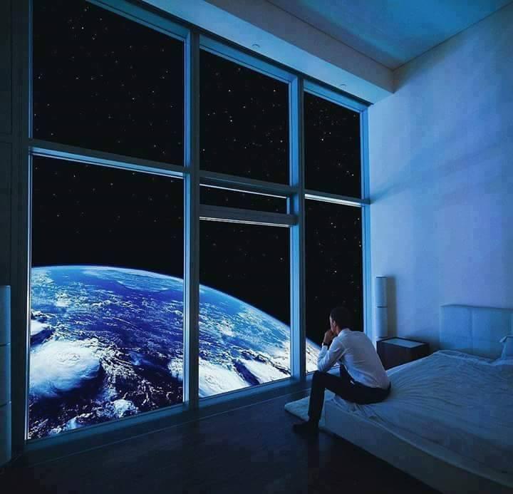
Look, Planet Citizens … Planet Earth
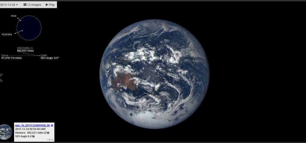
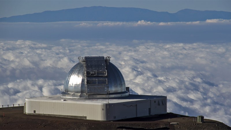
The DSCOVR Deep-Space Mission
From its origins, NASA has studied our planet in novel ways, using ingenious tools to study physical processes at work—from beneath the crust to the edge of the atmosphere. We look at it in macrocosm and microcosm, from the flow of one mountain stream to the flow of jet streams. Most of all, we look at Earth as a system, examining the cycles and processes—the water cycle, the carbon cycle, ocean circulation, the movement of heat—that interact and influence each other in a complex, dynamic dance across seasons and decades.
For all of the dynamism and detail we can observe from orbit, sometimes it is worth stepping back and simply admiring Earth. It is a beautiful, awe-inspiring place, and it is the only world most of us will ever know.
Of all celestial bodies within reach or view, as far as we can see, out to the edge, the most wonderful and marvelous and mysterious is turning out to be our own planet earth. There is nothing to match it anywhere, not yet anyway. — Lewis Thomas
Feb 12, 2015 / DSCOVR-EPIC Is Launched with SpaceX
GreenPolicy360 assists NASA’s mission team:
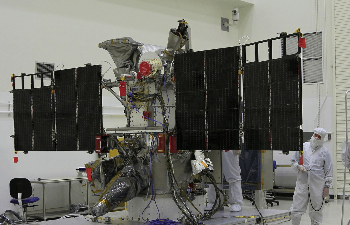
The DSCOVR satellite with its EPIC cam, PlasMag & NISTAR instrument package is on the way… a million miles toward the Sun then ‘parked’ in orbit to send data of/to earth, incl first whole earth photos since 1972.
Since 1972 and Apollo 18, the modern-day Earthrise- and Blue Marble-like photos have had to be stitched together from composite images. No more. With the successful launch and testing of the DSCOVR ‘deep space’ satellite with its EPIC imaging system, we have, as planet citizens, a new whole Earth perspective.
DSCOVR w EPIC cam, PlasMag & NISTAR
The Earth science data will be processed at NASA’s DSCOVR Science Operations Center and archived and distributed by NASA’s Atmospheric Science Data Center. Earth Polychromatic Imaging Camera (EPIC)
• http://www.nasa.gov/content/goddard/noaas-dscovr-to-provide-epic-views-of-earth/
• http://www.nesdis.noaa.gov/DSCOVR/pdf/DSCOVR%20-%20EPIC%20Instrument%20Info%20Sheet.pdf
• http://www.nesdis.noaa.gov/DSCOVR/
• http://mediaarchive.ksc.nasa.gov/search.cfm?cat=278%C2%A0%C2%A0%C2%A0
• https://www.greenpolicy360.net/w/File:DSCOVR_w_EPICcam,_PlasMag_%26_NISTAR.png
• https://www.greenpolicy360.net/w/File:DSCOVR-Day_before_Christmas2015.jpg
• https://www.greenpolicy360.net/w/Earth_Right_Now
#PlanetCitizens #PlanetaryAwareness
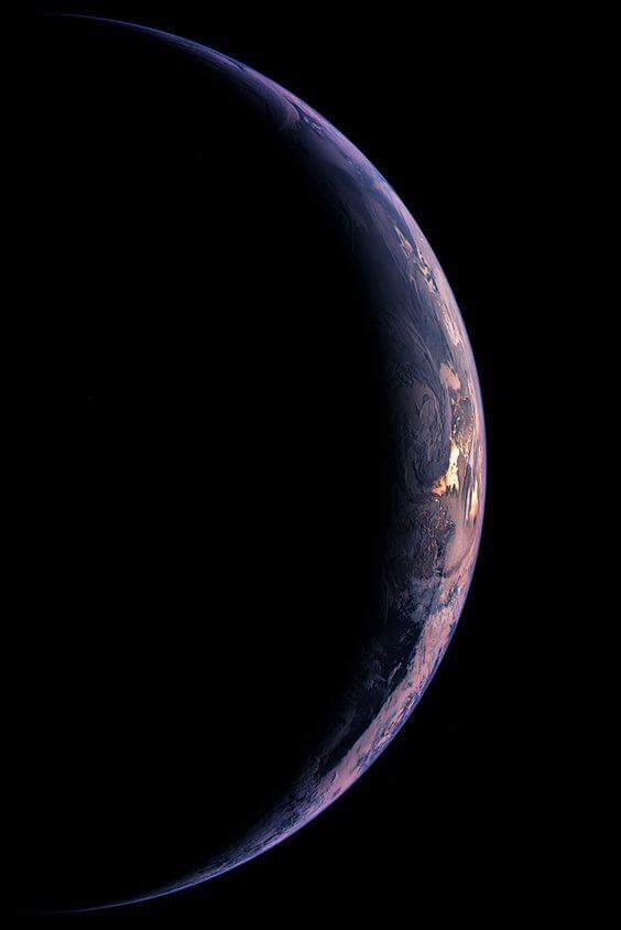
Earth, Sunrise, Sunset

