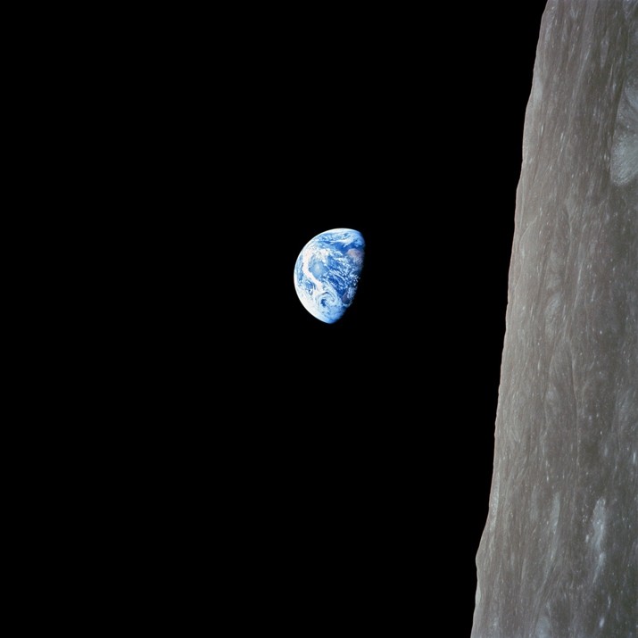
Celebrating the 1968 NASA mission that brought us “Earthrise”
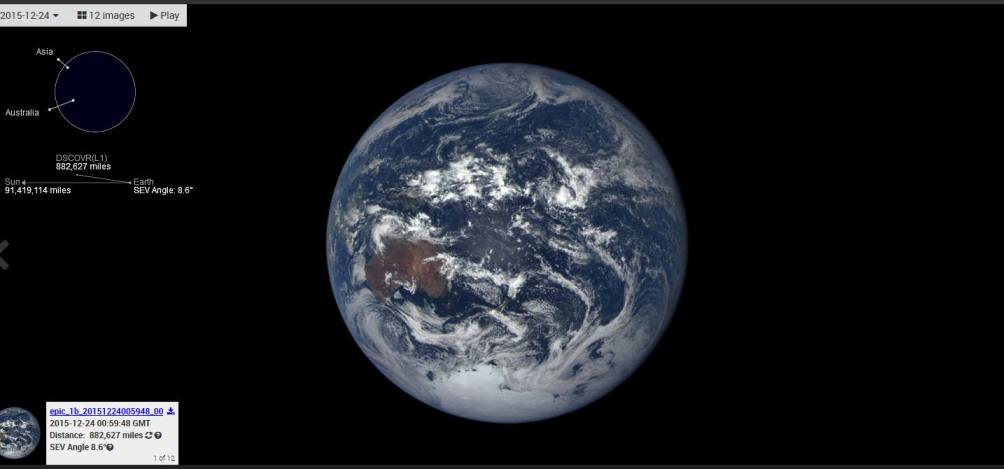
- And flashing forward to the DSCOVR-EPIC flight in 2015 when GreenPolicy360 assisted NASA’s mission team releasing first images of Earth ‘from a million miles’ — and now 2019 with NASA Earth science needed more than ever
• https://www.greenpolicy360.net/w/File:Apollo.jpg
• http://www.bbc.com/future/story/20181220-the-nasa-mission-that-broadcast-to-a-billion-people
• https://qz.com/1501935/photos-apollo-8-brought-us-the-moon-as-never-seen-before/amp/
• https://petapixel.com/2018/12/20/how-nasas-iconic-earthrise-photo-was-shot/
Look, Planet Citizens … Planet Earth
The DSCOVR Deep-Space Mission
From its origins, NASA has studied our planet in novel ways, using ingenious tools to study physical processes at work—from beneath the crust to the edge of the atmosphere. We look at it in macrocosm and microcosm, from the flow of one mountain stream to the flow of jet streams. Most of all, we look at Earth as a system, examining the cycles and processes—the water cycle, the carbon cycle, ocean circulation, the movement of heat—that interact and influence each other in a complex, dynamic dance across seasons and decades.
For all of the dynamism and detail we can observe from orbit, sometimes it is worth stepping back and simply admiring Earth. It is a beautiful, awe-inspiring place, and it is the only world most of us will ever know.
Of all celestial bodies within reach or view, as far as we can see, out to the edge, the most wonderful and marvelous and mysterious is turning out to be our own planet earth. There is nothing to match it anywhere, not yet anyway. — Lewis Thomas
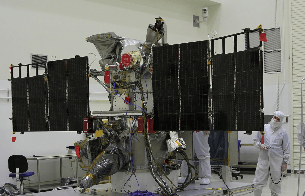
Feb 12, 2015 / DSCOVR-EPIC Is Launched with SpaceX
GreenPolicy360 assists NASA’s mission team:
The DSCOVR satellite with its EPIC cam, PlasMag & NISTAR instrument package is on the way… a million miles toward the Sun then ‘parked’ in orbit to send data of/to earth, incl first whole earth photos since 1972.
Since 1972 and Apollo 18, the modern-day Earthrise- and Blue Marble-like photos have had to be stitched together from composite images. No more. With the successful launch and testing of the DSCOVR ‘deep space’ satellite with its EPIC imaging system, we have, as planet citizens, a new whole Earth perspective.
DSCOVR w EPIC cam, PlasMag & NISTAR
The Earth science data will be processed at NASA’s DSCOVR Science Operations Center and archived and distributed by NASA’s Atmospheric Science Data Center. Earth Polychromatic Imaging Camera (EPIC)
• http://www.nasa.gov/content/goddard/noaas-dscovr-to-provide-epic-views-of-earth/
• http://www.nesdis.noaa.gov/DSCOVR/pdf/DSCOVR%20-%20EPIC%20Instrument%20Info%20Sheet.pdf
• http://www.nesdis.noaa.gov/DSCOVR/
• http://mediaarchive.ksc.nasa.gov/search.cfm?cat=278%C2%A0%C2%A0%C2%A0
• https://www.greenpolicy360.net/w/File:DSCOVR_w_EPICcam,_PlasMag_%26_NISTAR.png
• https://www.greenpolicy360.net/w/File:DSCOVR-Day_before_Christmas2015.jpg
• https://www.greenpolicy360.net/w/Earth_Right_Now
#PlanetCitizens #PlanetaryAwareness